The clearest way into the Universe is through a forest wilderness. - John Muir
11% of Washington County’s land is public land protected for open space or recreational use. Of this over 93% is state and federal parklands and wildlife management areas. Together with the community parks, these public lands provide a lot of opportunities for us to get out of the house, off the road, and into nature.
South Mountain State Park, on the Washington/Frederick County border provides over 13,000 wooded acres of year-round hiking on the Appalachian Trail, camping shelters, and seasonal hunting away from the trail.
The Appalachian Trail, is the longest marked footpath in the country (approximately 2,178 miles) It runs 41 miles along the ridge of South Mountain on the Washington/Frederick county border. It can be accessed in parks and where ever a road intersects it.
Gathland, Washington Monument and Greenbrier State Parks adjoin South Mountain State Park and provide access to the Appalachian Trail. Washington Monument and Gathland State Parks provide hiking paths and picnic areas. Greenbrier State Park offers mountain bike and hiking paths, boat launches and rentals, canoeing, swimming, and picnic and camping areas.
Cunningham Falls State Park, Just over the border in Frederick County, this beautiful wooded park offers boat launches and rentals, canoeing, and swimming, hiking, fishing, campsites, and picnic areas.
Catoctin Mountain Park, also in Frederick County offers scenic hiking, seasonal camping, and cabin and dormitory lodging.
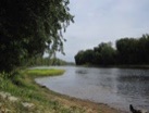
The Potomac River runs along the southern and western side of our County.
C&O Canal National Historical Park adjoins and buffers the Potomac River in Washington County for 79 miles of its 184.5-mile length. The river provides fishing, boating, rafting, and tubing opportunities as well as a scenic backdrop for walking, horseback riding, running, biking, bird watching, and visiting the preserved historical remnants of the canal along the towpath. Near Harpers Ferry National Historical Park:
The Maryland Heights Trail, departing from the towpath a little upriver of the walking bridge from Harpers Ferry scales the heights for some long views and interesting historical sites.
Beginning 1 mile west of Fort Frederick State Park at Big Pool off I-70: The Western Maryland Rail Trail is a 22.5 mile paved trail with its midpoint in Hancock and its western end at Pearre Station. It is open for hiking, jogging, inline skating, bicycling, and, weather permitting, cross-country skiing. Its easy grade and paved surface make this path ideal for the elderly and persons with disabilities.
The Tuscarora Trail crosses the Potomac River and intersects the C&O Canal National Historical Park near Hancock, continues along the towpath until Licking Creek, then runs north to Pennsylvania.
Fort Frederick State Park, near Big Pool, offers hiking trails, canoeing, fishing, camping, and picnic areas. There are parking areas and boat launches at many road access points along the length of the C&O Canal National Historical Park.
Indian Springs Wildlife Management Area s located near Clear Spring and offers a self-guided Nature Trail, hiking, picnic areas, fishing, hunting, a boat launch on a 30-acre lake, and lots of opportunities to view wildlife.
Sidling Hill Wildlife Management Area, on the western edge of the county, contains Sidling Hill Creek and the buffering state-owned lands to provide a water trail and ecological greenway.
For water fun and adventure, there are the Potomac River and creeks that are navigable by canoe and kayak at least some of the year. These water trails may connect parks. For instance Antietam Creek connects:
Devils Backbone Park, a small county park, with:
Antietam National Battlefield, a large well-preserved civil war battlefield and National Cemetery, and the C&O Canal National Historical Park as it flows to the Potomac River.
The slow meandering Conococheague and the brisker Antietam are generally navigable throughout the year although the Antietam can get very low in prolonged dry periods. Smaller creeks that can be kayaked or canoed in winter and spring within a few days of a hard rain are (east to west): Catoctin (2 – 4 days), Beaver Creek from I-70 Park & Ride to Alt. Route 40 (1-3 Days), Licking Creek (1 week), Tonoloway (1-3 days) and Sidling Hill (3-4 days). Some of these creeks run through private property but can be accessed from road bridge crossings and in parks. Apart from the Conococheague, these creeks and a section of the Potomac - from below Dam No 3 to Weverton - provide a fun and easy whitewater adventure. Because water has its own special hazards, knowledge, experience, and caution are advisable.
American Whitewater and River Facts are useful links for paddlers.
Link to Washington County Parks


